A drone flying over a field for ten minutes captures more usable data than a farmer walking that same field for a full day.
That gap is the entire case for precision agriculture technology. Not novelty. Not buzzwords. Just a fundamentally faster, more accurate way to see what is actually happening across thousands of acres.
The numbers back this up. According to Grand View Research, the global agriculture drones market was valued at $3.37 billion in 2025 and is projected to reach $21.59 billion by 2033. That is a 26.5 percent compound annual growth rate. Persistence Market Research puts the precision agriculture drone segment specifically at $3.3 billion in 2026, heading toward $13.9 billion by 2033.
These are not speculative projections from a vendor with something to sell. They come from independent market research firms tracking actual deployment and procurement data.
This guide covers what precision agriculture software actually does, how drones, IoT sensors, and AI analytics fit together as one system, and what it costs to build this kind of platform in 2026.
What Is Precision Agriculture Technology?
Precision agriculture technology treats farmland as a collection of individual zones rather than one uniform field.
A 200-acre field is never actually uniform. Soil composition varies. Drainage differs by elevation. Pest pressure concentrates in specific patches. A blanket approach to irrigation, fertiliser, and pest control wastes resources in the zones that need less and underserves the zones that need more.
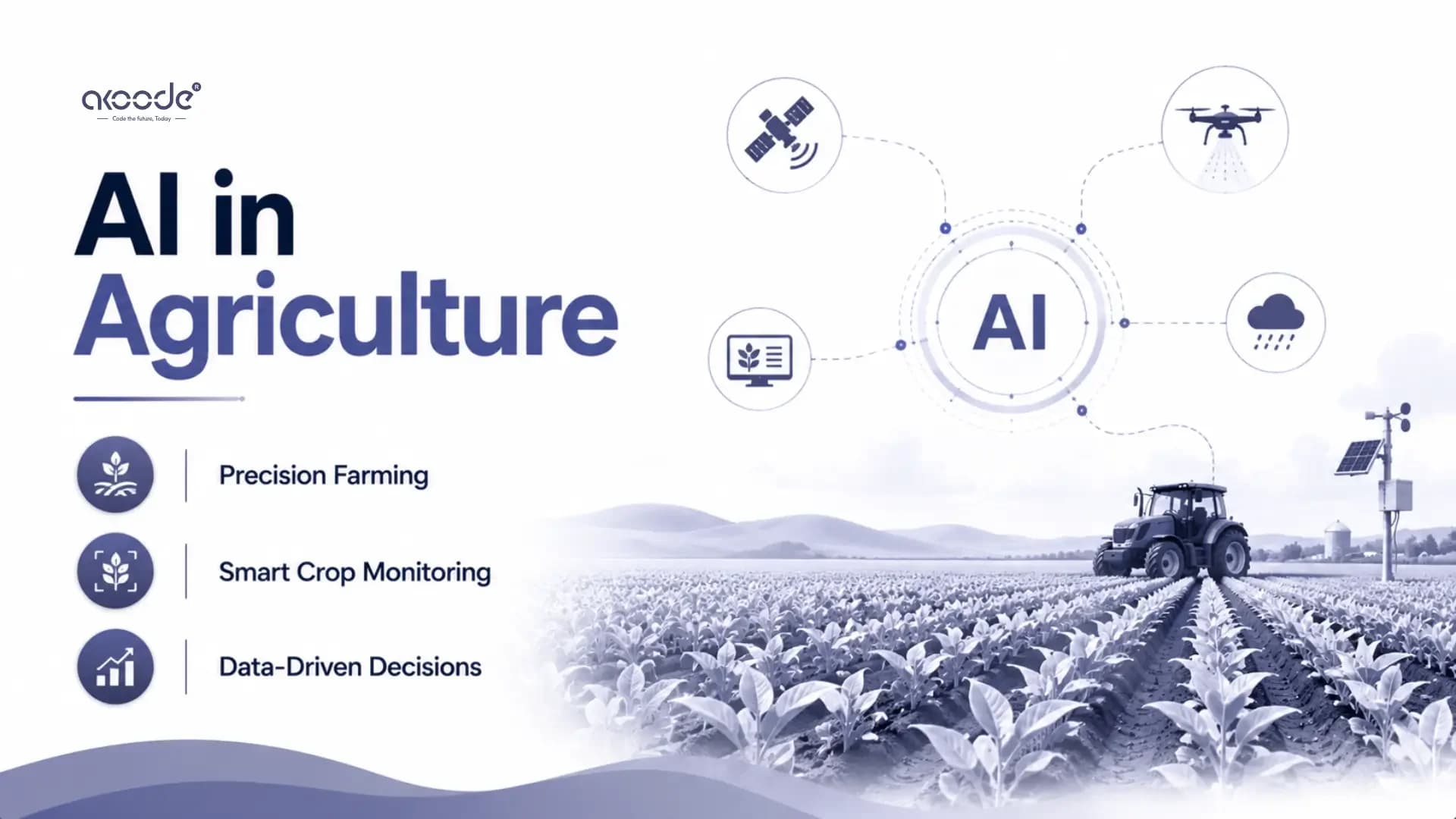
Precision agriculture software fixes this by collecting granular data from every part of a field and turning that data into zone-specific recommendations. The technology stack typically includes three layers working together.
Drones capture high-resolution aerial imagery on demand. IoT sensors placed directly in the soil and on equipment provide continuous ground-level data. AI analytics platforms ingest both data streams and convert them into decisions a farmer can actually act on.
None of these three layers replaces the others. They solve different problems. Understanding what each one does well, and where it falls short, is the foundation of building or buying the right system.
What Role Do Drones Play in Precision Agriculture?
Drones solve a coverage problem that no other technology handles as efficiently.
A single drone equipped with multispectral and thermal cameras can survey hundreds of acres in under an hour. It captures imagery far beyond what the human eye can detect. Plant stress, nutrient deficiency, and early disease signatures all show up in spectral bands invisible to standard cameras, well before visible symptoms would appear on the ground.
According to Coherent Market Insights, field mapping and monitoring is the single largest application segment in the agricultural drone market, accounting for roughly 34.7 percent of total market share in 2025. That is not a coincidence. Mapping is the use case that pays for itself fastest, because it replaces a slow, manual process with something that takes minutes.
Hardware costs have fallen sharply, which matters more than most coverage of this topic acknowledges. Entry-level agricultural drones that cost around $14,500 in 2016 now retail for $2,000 to $4,000, according to Mordor Intelligence's 2026 market analysis. Mid-range platforms with obstacle avoidance and automated mission planning, features that once appeared only on enterprise-tier equipment exceeding $20,000, now sell in the $8,000 to $15,000 range.
That price collapse is the real story behind drone adoption. It is not that farmers suddenly discovered drones. It is that drones became affordable enough for smallholder cooperatives to justify owning one rather than renting drone services seasonally.
China's regulatory environment offers a useful signal of where mass adoption leads. The country's Ministry of Agriculture and Rural Affairs had documented over 1.3 million agricultural multirotor drones registered specifically for crop protection by 2023. Companies like DJI and XAG built much of their commercial scale on exactly this market.
Rotary wing drones dominate the agricultural segment, holding roughly 61.7 to 72 percent of product type revenue depending on which market research firm's segmentation you reference. The reason is operational, not aesthetic. Vertical take-off, stable hovering, and low-altitude precision flight matter far more for crop spraying and close-range inspection than the longer flight range that fixed-wing drones offer.
How Do IoT Sensors Complement Drone Data?
If drones answer "what does the field look like right now," IoT sensors answer "what is happening continuously, even when nobody is flying a drone."
Soil sensors measure moisture, temperature, pH, and nutrient levels at fixed points across a field. Unlike a drone flight, which is a snapshot, sensors stream data continuously. That distinction matters more than it sounds. A drought stress signal that appears suddenly between two scheduled drone flights would be missed entirely without ground sensors filling that gap.
Weather stations placed directly in the field provide hyperlocal climate data. Regional weather forecasts are useful, but they smooth over the microclimate variation that actually determines irrigation timing within a single farm. A field with uneven terrain can have meaningfully different conditions across its own boundaries.
Equipment sensors on tractors, irrigation systems, and harvesters track usage, performance, and maintenance needs. This data feeds back into the same analytics platform that processes drone and soil data, creating one operational picture rather than three disconnected dashboards.
The practical value shows up clearly in irrigation. Customised, zone-specific irrigation scheduling driven by sensor data reduces water usage measurably compared to fixed-schedule irrigation across an entire field. The same logic applies to fertiliser. Precise, sensor-informed input application can cut fertiliser use significantly without sacrificing yield, simply because inputs go only where the data shows they are needed.
What Does the AI Analytics Layer Actually Do?
Drones and sensors generate enormous volumes of raw data. None of it is useful on its own. The AI analytics layer is what turns pixels and sensor readings into a decision a farmer can act on the same day.
Computer vision models process multispectral and hyperspectral drone imagery to calculate vegetation indices like NDVI, which quantify plant health across every section of a field. A trained model can flag a specific 0.3-acre patch showing early water stress while the rest of the field looks healthy on the surface.
Machine learning models combine historical yield data, current sensor readings, and weather forecasts to produce yield predictions that update through the growing season rather than sitting fixed at planting time. The same modelling approach supports variable-rate application planning, which determines exactly how much fertiliser, water, or pesticide each specific zone needs.
Predictive models also flag pest and disease risk before visible symptoms appear, based on patterns the model has learned from prior seasons combined with current weather and crop stage data. Catching a fungal disease risk three days before it becomes visible is the difference between a targeted spray and a field-wide intervention.
This is where the real precision agriculture value gets created. Not in any single sensor or any single drone flight, but in the layer that fuses everything into one coherent picture and tells a farmer exactly what to do, where, and when.
How Does a Precision Agriculture Platform Actually Work End to End?
Understanding the architecture matters for anyone evaluating or building one of these systems.
Data collection happens across multiple sources simultaneously. Scheduled or on-demand drone flights capture aerial imagery. IoT sensors stream continuous ground-level readings. Satellite imagery, where available, provides lower-resolution but wide-area coverage that complements drone data at a much lower cost per acre.
Data ingestion pipelines pull all of this into a central platform, typically cloud-based, where it gets normalised into a consistent format regardless of which sensor or drone model produced it.
The analytics layer processes this combined dataset. Computer vision models analyse imagery. Time-series models analyse sensor streams. The outputs get combined into field-zone-level recommendations.
The presentation layer is what the farmer or agronomist actually sees. A dashboard showing field health maps, irrigation recommendations, pest risk alerts, and yield forecasts. Mobile apps extend this to the field itself, since a farmer standing in a specific zone needs the recommendation for that exact location, not a generic report.
Action follows from this layer in one of two ways. Either a human reviews the recommendation and instructs equipment manually, or the system integrates directly with variable-rate application equipment and triggers the action automatically. The trend in 2026 is clearly toward the second model, though full automation still requires significant trust-building with the farmer, something covered in more detail in the broader AI in agriculture landscape.
What Does It Cost to Build Precision Agriculture Software?
Cost depends heavily on scope, but the major cost categories are consistent across projects.
Component | Cost Range |
|---|---|
Core platform (data ingestion, dashboard, basic analytics) | $40,000 to $90,000 |
Computer vision module for drone/satellite imagery | $30,000 to $80,000 |
IoT sensor integration and device management | $20,000 to $50,000 |
Predictive yield and risk modelling | $40,000 to $90,000 |
Mobile field app | $15,000 to $35,000 |
Variable-rate equipment integration | $20,000 to $60,000 |
A full platform combining all of these components typically lands between $150,000 and $350,000 for a production-grade system. A focused MVP covering core mapping and one or two predictive features can be scoped at $60,000 to $100,000.
Team location affects this significantly, as it does across most software categories. A platform costing $250,000 with a US-based team can be delivered for $70,000 to $100,000 with an experienced India-based development partner, without compromising on the underlying computer vision or machine learning capability.
Ongoing costs matter as much as the build cost here. Satellite imagery licensing, cloud compute for processing high-resolution imagery, and continuous model retraining as seasons change all represent real recurring expenses that a one-time development quote will not capture.
Should You Build Custom Software or Use an Existing Platform?
Established platforms in this space, built by companies with years of accumulated agronomic data, offer a genuine advantage that is hard for a new entrant to replicate quickly: the models are already trained on large historical datasets across many farms and regions.
For an individual farm or a smaller agribusiness, adopting an existing platform is usually the faster and more capital-efficient path. The cost is typically subscription-based rather than a large upfront development investment.
Custom development becomes the right call in a few specific situations. An agritech company building a product to sell needs a platform of its own, not a license to someone else's. A large agribusiness with proprietary data, specific crop types, or unusual regional conditions that off-the-shelf models do not handle well often gets meaningfully better results from a custom-trained model. And organisations that need deep integration with existing farm management, ERP, or equipment systems frequently find that integration work alone justifies a custom build.
The right starting point, in nearly every case, is identifying one specific high-value use case rather than attempting to build the entire stack at once. Field mapping and pest risk detection tend to deliver the fastest, most visible payback, which makes them the sensible place to prove value before expanding into yield prediction or full automation.
Conclusion
Precision agriculture software is not one technology. It is three technologies, drones, IoT sensors, and AI analytics, working as a single system that sees more, sees it faster, and turns it into action a farmer can actually take that same day.
The market data is unambiguous about where this is heading. Whether you look at Grand View Research's $21.59 billion 2033 projection or Persistence Market Research's $13.9 billion drone-specific figure, every credible market research firm tracking this space points in the same direction: continued double-digit annual growth through the early 2030s.
For agribusinesses and agritech companies deciding whether to build, the right approach starts narrow. Pick the use case with the clearest payback. Build the data foundation properly. Expand from there.
Akoode Technologies is a leading AI and software development company headquartered in Gurugram, India, with a US office in Oklahoma. From AI-powered software development and computer vision systems to IoT solutions and custom enterprise platforms, Akoode builds precision agriculture and agritech software for startups, agribusinesses, and enterprise clients across 15+ industries globally. If you are building a precision agriculture platform and want a team that understands both the computer vision and the IoT engineering it requires, that conversation starts here.
Frequently Asked Question
1. What is precision agriculture software?
Precision agriculture software combines data from drones, IoT sensors, and satellite imagery into one platform that uses AI analytics to generate zone-specific recommendations for irrigation, fertiliser, and pest control. It replaces uniform field management with decisions tailored to specific sections of a field.
2. Why are drones important in agriculture?
Drones capture high-resolution aerial imagery, including multispectral and thermal data invisible to the human eye, across hundreds of acres in under an hour. According to Coherent Market Insights, field mapping and monitoring is the largest application segment in the agricultural drone market, accounting for roughly 34.7 percent of revenue in 2025.
3. What is the precision agriculture drone market size in 2026?
Persistence Market Research values the global precision agriculture drone market at $3.3 billion in 2026, projected to reach $13.9 billion by 2033 at a 22.8 percent annual growth rate. Grand View Research's broader agriculture drones market figure was $3.37 billion in 2025, projected to reach $21.59 billion by 2033.
4. How much does precision agriculture software cost to build?
A full platform combining drone imagery analysis, IoT sensor integration, and predictive modelling typically costs $150,000 to $350,000 for a production-grade system. A focused MVP covering core mapping and one or two predictive features can be scoped at $60,000 to $100,000. India-based development teams typically deliver the same scope at 30 to 40 percent of US team cost.
5. How have agricultural drone prices changed?
According to Mordor Intelligence's 2026 analysis, entry-level agricultural drones that cost around $14,500 in 2016 now retail for $2,000 to $4,000. Mid-range platforms with obstacle avoidance and automated mission planning, once exclusive to enterprise-tier equipment over $20,000, now sell for $8,000 to $15,000.
6. Should a farm buy an existing precision agriculture platform or build custom software?
Most individual farms and smaller agribusinesses benefit from adopting an existing subscription-based platform, since established providers have models already trained on large historical datasets. Custom development makes sense for agritech companies building a product to sell, large agribusinesses with proprietary data or unusual regional conditions, and organisations needing deep integration with existing farm management systems.